

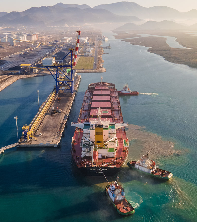

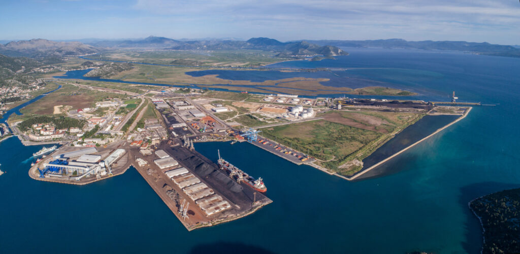
Luka Ploče kao dio glavne europske TEN-T mreže povezuje Jadransko more s unutrašnjošću Europe, omogućavajući brži transport roba.

Postajemo suvremena luka kroz automatizaciju procesa i senzoriku uz istovremeno povećanje kapaciteta podržavajući međunarodnu trgovinu i održivi razvoj.

Koncesionar: Luka Ploče d.d.

Koncesionar: Luka Ploče d.d.

Koncesionar: Luka Ploče d.d.

Potkoncesionar: Eko Južni Jadran d.o.o.
Potkoncesionar: Luka Ploče gradnja d.o.o.

Koncesionar: Adriatic Tank Terminals d.o.o.

Koncesionar: Luka Ploče d.d.


Osigurava učinkovitu opskrbu rasutim teretima, optimizirajući protok roba.
Moderna infrastruktura za brzu i sigurnu manipulaciju kontejnerima.

Terminal specijaliziran za upravljanje rasutim teretima s visokom efikasnošću.
Rješenja za siguran transport i skladištenje sipkih materijala, poput minerala i žitarica.
Primarni terminal za prijem i distribuciju roba, osiguravajući nesmetan ulaz u luku.

Putnički terminal namijenjen prihvatu i otpremi putnika, s naglaskom na sigurnost putničkog prometa.
Osigurava učinkovitu opskrbu rasutim teretima, optimizirajući protok roba.
Moderna infrastruktura za brzu i sigurnu manipulaciju kontejnerima.
Terminal specijaliziran za upravljanje rasutim teretima s visokom efikasnošću.
Rješenja za siguran transport i skladištenje sipkih materijala, poput minerala i žitarica.
Primarni terminal za prijem i distribuciju roba, osiguravajući nesmetan ulaz u luku.
Putnički terminal namijenjen prihvatu i otpremi putnika, s naglaskom na sigurnost putničkog prometa.